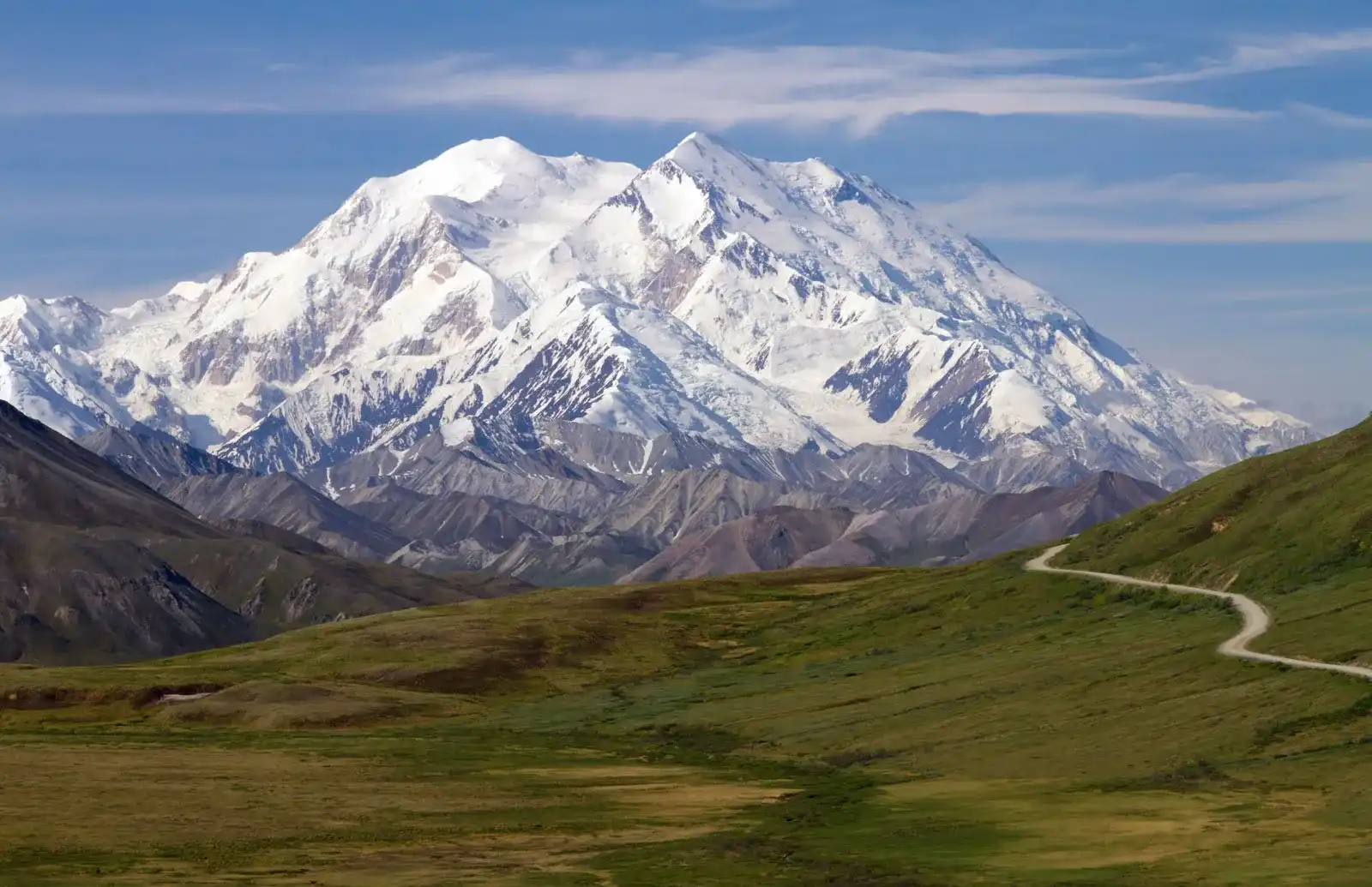
Denali National Park and Preserve encompasses 6 million acres of Alaska’s interior wilderness. Its centerpiece is 20,310-ft.-high Denali (fka Mount McKinley), North America’s tallest peak. With terrain of tundra, spruce forest and glaciers, the park is home to wildlife including grizzly bears, wolves, moose, caribou and Dall sheep. Popular activities in summer include biking, backpacking, hiking and mountaineering.

Denali National Park and Preserve includes the central, highest portion of the Alaska Range, together with many of the glaciers and glacial valleys running southwards out of the range. To the north the park and preserve encompass the valleys of the McKinley, Toklat and Foraker Rivers, as well as the Kantishna and Wyoming Hills. The George Parks Highway runs along the eastern edge of the park, crossing the Alaska Range at the divide between the valleys of the Chultina River and the Nenana River. The entrance to the park is about 11 miles (18 km) south of Healy. The Denali Visitor Center and the park headquarters are located just inside the entrance. The park road parallels the Alaska Range for 92 miles (148 km), ending at Kantishna. Preserve lands are located on the west side of the park, with one parcel encompassing areas of lakes in the Highpower Creek and Muddy River areas, and the second preserve area covering the southwest end of the high Alaska Range around Mount Dall. In contrast to the park, where hunting is prohibited or restricted to subsistence hunting by local residents, sport hunting is allowed in the preserve lands.[19] Nikolai, Telida, Lake Minchumina, and Cantwell residents are authorized to hunt inside the park because large portions of these communities historically hunted in the area for subsistence purposes.
Glaciers
Glaciers cover about 16% of the 6 million acres of Denali National Park and Preserve. Measurements indicate that glaciers in the park are losing about 6.6 ft (2 m) of vertical water equivalency each year.[30] There are more extensive glaciers on the southeastern side of the range because more snow is dropped on this side from the moisture-bearing winds from the Gulf of Alaska. The 5 largest south-facing glaciers are Yentna (20 miles (32 km) long), Kahiltna (30 miles (48 km)), Tokositna (23 miles (37 km)), Ruth (31 miles (50 km)), and Eldrige (30 miles (48 km)).[27] The Ruth glacier is 3,800 feet (1,200 m) thick.[29] However, the largest glacier, Muldrow Glacier (32 miles (51 km) long), is located on the north side. Nonetheless, the northern side has smaller and shorter glaciers overall. Muldrow glacier has "surged" twice in the last hundred years. Surging means that it has moved forward for a short time at greatly increased speed, due to a build-up of water between the bottom of the glacier and the bedrock channel floating on the ice (due to hydrostatic pressure)
